Coming soon: two specially commissioned maps of ‘Revolutionary Paris in the Elbeuf Letters’ and ‘The world of the Elbeuf Letters’. Meanwhile, here are some other useful maps to use alongside the Letters:
Paris during the French Revolution (scroll down under the map description to see the map itself).
A map of Revolutionary Paris with some embedded images and contextual information (from another online resource about the Revolutionary writer Olympe de Gouges).
Versailles in 1789 (including the location of the Estates General and National Constituent Assembly—until the October move to Paris—in the bottom right-hand corner, below the Avenue de Paris and numbered 7-10).
General maps of France in the eighteenth century and during the Revolutionary (see the list on the left of this page).
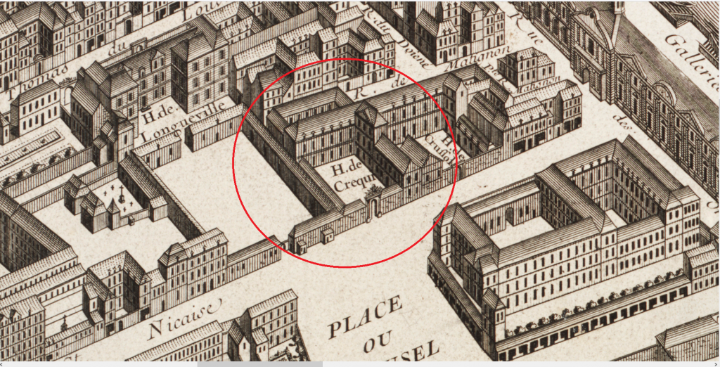
The 1739 Turgot map of Paris (illustrating the prominence of the Hôtel d’Elbeuf, which the duchess had inherited seven years previously but which is here still recorded under its former name: the Hôtel de Créqui). The Hôtel is in this central section of the map at the top end of the Place du Carrousel, just above the Cour des Tuileries.